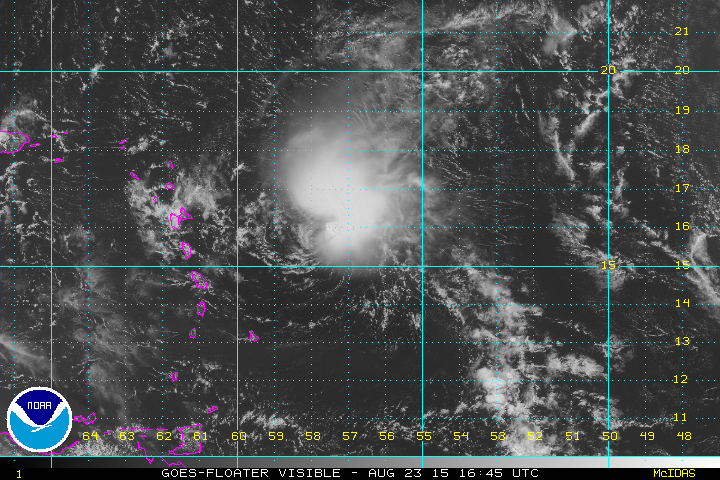
As of 7:00 AM EDT/AST
Tropical Storm Erika now has winds sustained at 45 knots (50 MPH), and a pressure of about 1003 millibars. The storm will likely continue to west-northwestward track at about 15 mph and impact Puerto Rico, the Virgin Islands, parts of Hispaniola, the Turks and Caicos, and The Bahamas over the next few days.
Let’s Talk Track
Overnight, the main computer models along with many spaghetti models seem to have locked in on their track for Tropical Storm Erika, the newest main track calls for a turn to the north, as expected, while over the Bahamas, leaving most of the state of Florida likely in the clear. Over the next few days, Tropical Storm Erika will ride over the Virgin Islands and Puerto Rico, skim northeastern parts of Hispaniola, do a direct hit on the Turks and Caicos and The Bahamas, and skim the Eastern Florida coastline.
The Computer Models, What’s New?
As said before, the spaghetti models along with all the global computer models have seemed to lock in their newest projection for Erika’s track to at least parts of the East Coast, but what about intensity? Of course, along with track, the intensity must change as well, and believe us when we say change. One may not think the following change is any more than moderately significant, but in truth, even a difference of about 10 MPH in wind speed can mean the difference between little and major damage. At the same time yesterday, the spaghetti intensity models where still all over the place, but as of last night, more and more computer models became more grouped together, leaving us with two main possibilities, either this storm will strengthen rapidly over the Bahamas, or Erika will strengthen over the next several days slowly. Both of these possibilities do say there would be a hurricane either of above Category Three status, or mid-grade Category One status in about 5 days.
Most Global Computer Models such as the GFS and the ECMWF, will became a bit more infrequently used in the immediate track, meaning that over the next few days, the shorter range and more accurate computer models will be given a bigger shot at Tropical Storm Erika.
Official Alerts: Tropical Storm Warnings are in effect for the northern Leeward Islands, The Virgin Islands, and Puerto Rico. Tropical Storm Watches remain in effect for southern parts of the Leeward Islands, northern portions of the Dominican Republic, the Turks and Caicos, and the southern parts of the Bahamas.
Weather 360 3.A.S.: Level I Emergency for locations under Tropical Storm Warnings, Level II Alert for locations under Tropical Storm Watches, and a Level III, be aware statement, for locations from Miami to The Outer Banks along with the entirety of the Eastern Seaboard.
Weather 360 will continue to keep you updated on the progress of Tropical Storm Erika, stay safe!


 These are images both available from TropicalTidbits.com, these images illustrate the the spaghetti models for Danny on a simpler format.
