Major Snowstorm Soon?

The potential for a significant snow event exists over the upcoming weekend.  The National Weather Service has kept the odds of this storm in the NYC Metro Area around 70%, as there is still great uncertainty to the exact path of this nor’easter.

The most recent run of the GFS and the ECMWF brings the low pressure system a bit further north,  which means more winds above 20 MPH and potentially over a foot of snow in the Metropolitan Area.   Some short range computer models have continued to flip-flop on their positions, rendering them currently unreliable.  Another small shift to the north and this low pressure could bring more extreme snow accumulations to the area.

At the moment, there is still great uncertainty in the path and intensity of this storm, so don’t take the latest forecast to be the only forecast.  The odds are, most of the computer models will continue to flip-flop at least once or twice more before settling down on one forecast.

For more information, visit our Winter Weather Center page.

Winter 2015-2016 Snow Total Forecasts!

The following pertains to the New York City Metropolitan Area from Nov. 1 – April 1 2016

Winter 2015-2016 Snow Total Forecasts:

The following Weather360 forecast was made by a process in the making for nearly a year.

The New York City Metro Area is likely to receive about 20 more inches of snow than normal. This in part is due to the current El Nino bringing more precipitation to the area, along with current computer model trends that suggest average temperatures in this area will also likely be most prevalent.  Other factors such as Global Emissions and average precipitation and temperature amounts have been taken into account.

For more specific locations expected snow total amounts, visit our Climate360 page.

Happy Birthday Weather360!

Exactly one year ago, this website was opened to serve the Northeast United States and those with interests across the Tropical Atlantic Basin with the best weather forecasting service we could offer.  One year later, Weather360 has reached almost 2,000 people, and has constantly improved our website interface and methods of weather prediction.  Over the next year, we plan to start using several new methods of short and long term weather forecasting to ensure consistently accurate forecasts.

Thanks for your support- Weather360

Come back soon for an update on the current storms in the Tropical Atlantic Basin.

MAJOR 8.3 EARTHQUAKE STRIKES CHILE, TSUNAMI WATCHES TRIGGERED IN THE PACIFIC

EMERGENCY STATEMENT FOR THE HAWAIIAN ISLANDS FROM THE PTWC AT 2:00 PM HST

FOR THOSE WITH INTERESTS ACROSS THE PACIFIC BASIN, PLEASE CONTINUE TO MONITOR THE SITUATION

TSUHWX
HIZ001>003-005>009-012>014-016>021-023>026-170225-
/O.CON.PHEB.TS.A.0002.000000T0000Z-000000T0000Z/

BULLETIN
TSUNAMI MESSAGE NUMBER   3
NWS PACIFIC TSUNAMI WARNING CENTER EWA BEACH HI
224 PM HST WED SEP 16 2015

TO - EMERGENCY MANAGEMENT IN THE STATE OF HAWAII

SUBJECT - TSUNAMI WATCH SUPPLEMENT

A TSUNAMI WATCH CONTINUES IN EFFECT FOR THE STATE OF HAWAII.

AN EARTHQUAKE HAS OCCURRED WITH THESE PRELIMINARY PARAMETERS

   ORIGIN TIME - 1254 PM HST 16 SEP 2015
   COORDINATES - 31.5 SOUTH   72.0 WEST
   LOCATION    - NEAR THE COAST OF CENTRAL CHILE
   MAGNITUDE   - 8.3  MOMENT

MEASUREMENTS OR REPORTS OF TSUNAMI WAVE ACTIVITY

 GAUGE LOCATION        LAT   LON    TIME        AMPL         PER
 -------------------  ----- ------  -----  ---------------  -----
 VALPARAISO CL        33.0S  71.6W  2350Z   1.62M /  5.3FT  40MIN
 CHANARAL CL          26.4S  70.6W  0010Z   0.67M /  2.2FT  34MIN
 JUAN FERNANDEZ       33.6S  78.8W  0008Z   0.97M /  3.2FT  08MIN
 COQUIMBO CL          30.0S  71.3W  2339Z   3.11M / 10.2FT  20MIN
 BUCALEMU CL          34.6S  72.0W  2334Z   0.46M /  1.5FT  24MIN
 CALDERA CL           27.1S  70.8W  2343Z   0.50M /  1.6FT  30MIN
 SAN ANTONIO CL       33.6S  71.6W  2358Z   0.86M /  2.8FT  18MIN
 DART 32402           26.7S  74.0W  2326Z   0.12M /  0.4FT  36MIN

 LAT  - LATITUDE (N-NORTH, S-SOUTH)
 LON  - LONGITUDE (E-EAST, W-WEST)
 TIME - TIME OF THE MEASUREMENT (Z IS UTC IS GREENWICH TIME)
 AMPL - TSUNAMI AMPLITUDE MEASURED RELATIVE TO NORMAL SEA LEVEL.
        IT IS ...NOT... CREST-TO-TROUGH WAVE HEIGHT.
        VALUES ARE GIVEN IN BOTH METERS(M) AND FEET(FT).
 PER  - PERIOD OF TIME IN MINUTES(MIN) FROM ONE WAVE TO THE NEXT.

 NOTE - DART MEASUREMENTS ARE FROM THE DEEP OCEAN AND THEY
        ARE GENERALLY MUCH SMALLER THAN WOULD BE COASTAL
         MEASUREMENTS AT SIMILAR LOCATIONS.

EVALUATION

 BASED ON ALL AVAILABLE DATA A TSUNAMI MAY HAVE BEEN GENERATED BY
 THIS EARTHQUAKE THAT COULD BE DESTRUCTIVE ON COASTAL AREAS EVEN
 FAR FROM THE EPICENTER. AN INVESTIGATION IS UNDERWAY TO DETERMINE
 IF THERE IS A TSUNAMI THREAT TO HAWAII.

 IF TSUNAMI WAVES IMPACT HAWAII THE ESTIMATED EARLIEST ARRIVAL OF
 THE FIRST TSUNAMI WAVE IS

                     0311 AM HST THU 17 SEP 2015

FURTHER MESSAGES WILL BE ISSUED HOURLY OR SOONER AS CONDITIONS
WARRANT UNTIL THE THREAT TO HAWAII HAS PASSED.

$

Ignacio expected not to impact Hawaii

Weather Bulletin: 7:30 AM EDT/ 1:30 AM HST 8/31/2015

Tropical Storm Watches have been discontinued for the Hawaiian Islands.

Hurricane Warnings are now in effect for maritime locations around the islands.

High surf advisories are in effect for land locations on storm facing parts of some islands.

Map of Forecast Area

Please visit Weather.gov for more information regarding watches and warnings currently in effect.

Tropical Storm Erika may pose threat to entire East Coast if models hold through

BREAKING WEATHER NEWS: 3:45 PM EDT/AST

It is now almost 4 o’clock across the Eastern Seaboard of the US and with the latest run of the computer model runs, some fairly intriguing information has come out as well.

What’s happening?

As of the 12 UTC update, several computer models that do bring Erika up the East Coast, also bring Erika to Category 4 and Category 5 status while nearing the Outer Banks.  This could, if true, mean that a potential catastrophic disaster could be felt anywhere from Florida, to New England, with that in mind, we do remind you that some computer models do still bring a weaker system into Florida, which would avert a potential catastrophe.  For anyone from Florida to New England, we do advise to at least be thinking about preparation for this potential storm.

For those in the Caribbean Islands, including Hispaniola, The Turks and Caicos, and The Bahamas, we recommend immediate action, as we expect a slight shift in the track by the NHC over the next hour.

Bottom Line:  BE PREPARED, Don’t let a storm catch you off guard.

We will continue to keep you updated on the progress of Erika.

Danny downgraded to Tropical Storm, while computer models seem to be going crazy

As of 1:30 PM EDT/AST August 23, 2015

Now Tropical Storm Danny is making its move on its first target, The Leeward Islands.  Already, Tropical Storm warnings are in effect for locations in the northern portions of the islands, along with newly issued Tropical Storm watches for Puerto Rico and the Virgin Islands.  This means that Tropical Storm conditions are possible or are expected over the following few days.

Track/Intensity 

So, where is Danny going?

That is the question most are asking at the moment, although, Danny wont be going anywhere if he doesn’t survive the harsh environment he has moved into.  This, of course, consists of a ton of wind shear created by the El Nino that is expected to gain strength and potentially bring an end to the California drought this winter.  The wind shear was supposed to, at least by now, make Danny a bit smaller and less defined, but viewing the following (as of 1:30 PM EDT/AST), you may see something other than that.

August 23 2015 Hurricane DANNY image

This image shows that Danny is still fighting the wind shear, and although is a bit less defined, is still expanding and has more and more convection towards the center of the storm.

At the moment the National Hurricane Center is one of the lead downers in terms of computer model forecast for intensity.  With the forecast that Danny will fizzle out by the Bahamas, you can begin to imagine the differences that have been created between the OFCL (NHC computer model), and a computer model such as the GNTI computer model, which at the moment as of 12 UTC August 23 2015 suggests a category four hurricane to be off the coast of the Carolinas over the next week and a half.

Model Forecast Tracks

Model Intensity Forecasts 
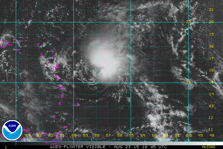
These are images both available from TropicalTidbits.com, these images illustrate the the spaghetti models for Danny on a simpler format.

None of these forecasts are official, except of course for the NHC forecast below.

NHC Forecast Track

We’ll keep you updated as more information comes out over the next few days.

Also related on our Hurricanes 360 page: Tropical Storm Danny, and Invest 98L

HURRICANE DANNY QUICKLY STRENGTHENS WHILE KEEPING ITS EYE SET ON THE CARIBBEAN ISLANDS

As of 11 AM this morning, Hurricane Danny is a 105 MPH wind, category two hurricane, with a pressure of about 980 millibars, and is making its way slowly to the west-northwest at about 12 MPH.

Not only was this not expected at this time, but due to this rapid strengthening, the intensity models have been steadily increasing the forecasted strength of Danny over the next week or so.

Model Intensity Forecasts This is the intensity spaghetti model forecast provided by Tropical Tidbits.

Where is Danny Heading?

Locations that may be impacted by Danny over the next five days are the following:  The northern Leeward Islands, The Virgin Islands, Puerto Rico, Hispaniola, The Turks and Caicos, and the Bahamas.

At the moment we are not ruling out a US impact by any means.

Visit our Hurricanes page for more information on the intensity and path of Hurricane Danny.

FINAL REVISIONS OF WEATHER 360’S 3-LEVELED ALERT SYSTEM

We here at Weather 360 unveiled our 3-Leveled Alert System recently and have received several comments and pieces of advice on how to improve this system.  With this advise, we have created a fairly simple and refined version of this system, which we will now present.

Level III: Be aware, the potential for hazardous weather exists

Level II: Be alert, the potential for threatening weather exists

Level I; Emergency, threatening weather imminent

There you go, the most simple and refined version of the 3.A.S.

Tropical Depression Four expected to strengthen and move towards Caribbean

This morning at 8 AM Eastern Time, the NHC declared former Invest 96L a Tropical Depression, the fourth of the season in the Tropical Atlantic Basin.  With a tightening circulation and strengthening winds, we here at Weather 360 can start to assume that this system will become Tropical Storm Danny shortly.  Although this system is moving slowly, and any impact to land is days out, many computer models are not ruling out the potential for a full-scale hurricane to form briefly before impacting the Lesser Antilles over the next several days to a week.

IR Satellite Image

The most recent satellite image from the NOAA of TD Four

We’ll keep you posted