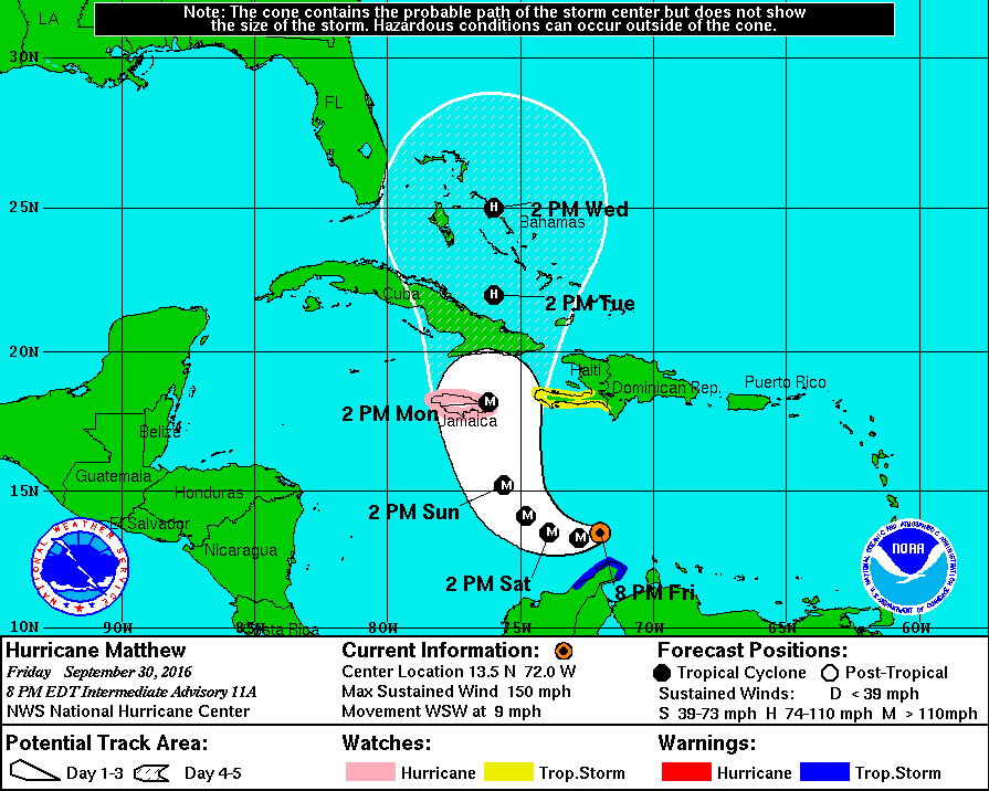
The monster category 4 Hurricane Matthew is now beginning its path of destruction as it nears the northern Caribbean Islands. Up to over a foot of rain is expected over a wide swath of Haiti, Cuba, and Jamaica, creating the possibility for mudslides and flash flooding.

Hurricane conditions can be expected across Jamaica, eastern Cuba, and all of Haiti over the next 48 hours, and hurricane conditions are increasingly likely for large swaths of the Bahamas as well as The Turks and Caicos.
After about 72 hours out, the forecast becomes a bit less certain, as it begins to be reliant on, multiple factors, for now, we’ll focus on two.
- Factor 1: The low pressure system in the Pacific Northwest is weaker than expected, meaning that once it reaches Hurricane Matthew on the East Coast (if at all), it will not be able to slingshot the storm away from the coast as previously thought.
- Factor 2: The high pressure system in the Atlantic is much more dominant than expected, indicating that it may act as a block in Matthew’s path, forcing it much, much closer to the coast, as reflected in last night’s shift in the spaghetti model plots.
*Hurricane Matthew is an extremely dangerous storm, it is highly recommended to prepare and evacuate as ordered by your local governments should they do so. Please consult The National Hurricane Center at http://www.nhc.noaa.gov for more info.*


 This is the intensity spaghetti model forecast provided by Tropical Tidbits.