Impacts from Post-Tropical Storm Hermine in The Tri-State Area
Est. September 2014

Impacts from Post-Tropical Storm Hermine in The Tri-State Area
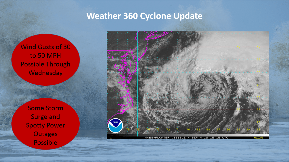
Hermine continued its east-northeastward track overnight, bringing it to the eastern side of the NHC’s ‘cone of uncertainty’. Although the effects from Hermine along the coast will be less significant for large swaths of The Mid Atlantic and southwestern New England, Hermine still poses a threat to life and property.
Labor Day Weekend is normally a time when people go to the beaches to celebrate the unofficial end of summer, but rip currents, high waves, and high winds from Atlantic City to Boston may put a damper on your plans. Along with this, expect there to be wind gusts high enough to bring down some large branches and trees, especially on Monday, bringing up the potential for some spotty power outages.
For more information on Hermine, visit our Tropical Cyclones page and check for official information at hurricanes.gov and weather.gov.

The National Weather Service in Upton, New York has issued Tropical Storm Warnings for locations across The Tri-State Area. Storm Surge Watches and Warnings are also in effect.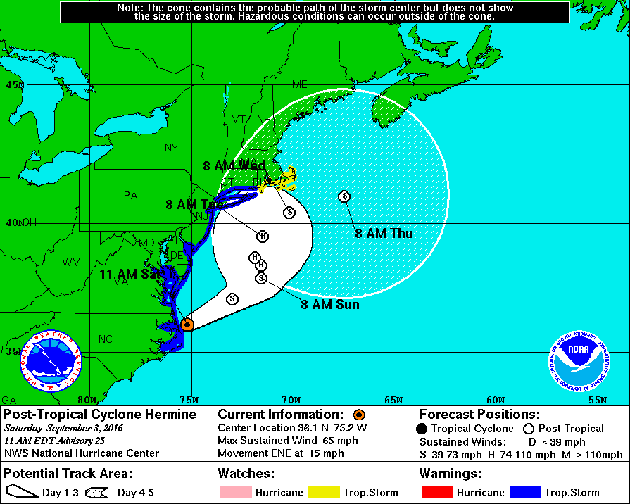
Sustained winds in excess of 40-60 MPH are possible with this storm from New Jersey to Connecticut, creating the potential for widespread power outages, blocked roads, and high waves. The National Hurricane Center is expecting a storm surge of anywhere between 1 and 8 feet depending on the location, especially on the south facing shores of Long Island. Now is the time to act! Make sure you have a 3 day supply of food and water as well as flashlights, a weather radio, and portable batteries if at all possible. If evacuations are ordered for your area, do not hesitate to leave. The potential track for this storm remains somewhat uncertain, so please stay informed over the following several days. Official information may be found at hurricanes.gov (NHC), and at weather.gov (NWS).

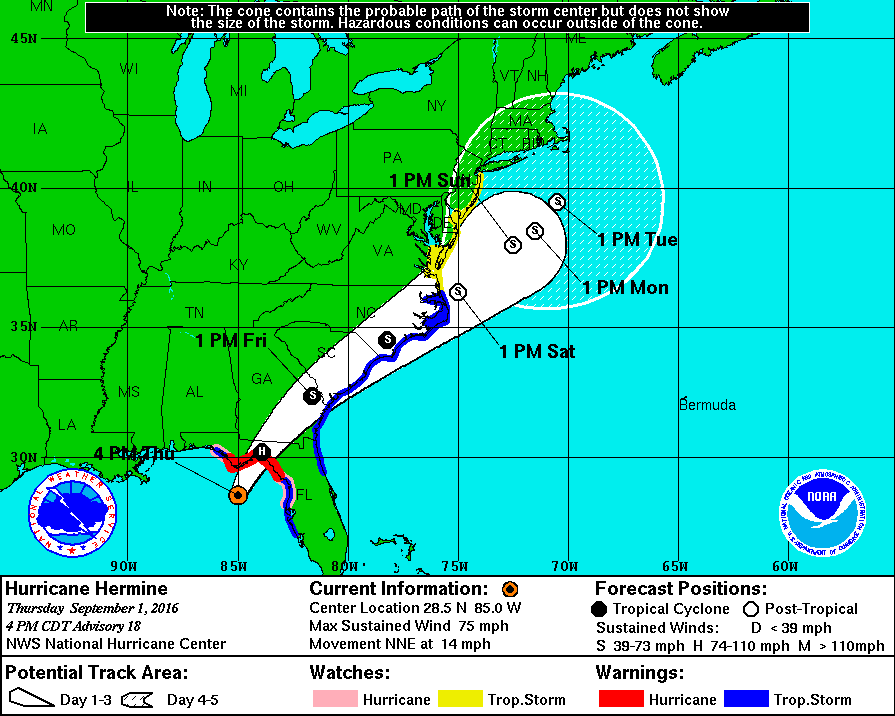
Hurricane Hermine will make history tonight as it will be the first storm of its status to make landfall in Florida in over a decade. Over the past week, what is now Hurricane Hermine went from being an area of exposed low-level circulation to what is now an organized storm capable of producing winds of 75 MPH as well as a storm surge of up to 8 feet on the coast. After impacting Florida tonight, the storm is expected to skirt the Southeast coast with winds exceeding 50 MPH before moving out over the waters off the Mid Atlantic coast. The following is an image from The NHC displaying the expected track of Hermine as well as current watches and warnings.
This storm poses a serious threat to both life and property and has the potential to affect millions across The East Coast. Please consult the National Weather Service at weather.gov for your local watches, warnings, and advisories.

Tropical Depression 9, the swirling mass of clouds just to the north of The Yucatan in the image to the left, is expected to intensify into a Tropical Storm sometime over the next several hours. The warm waters of The Gulf combined with little shear has finally allowed this storm to grow rapidly over the past couple of days. The National Hurricane Center (NHC) has issued Hurricane Watches as well as Tropical Storm Warnings for much of the Big Bend area of Florida north of Tampa. Although the storm is not currently expected to become a hurricane before landfall, it will come close to doing so with sustained winds of about 65 MPH, so Hurricane Watches are still in effect for the area. Although a sort of model consensus has been reached regarding the short term for this storm, mayhem continues as some computer models have begun to indicate a shift to the west once it passes North Carolina. If this storm were to shift to the west as now indicated by some of the more trustworthy computer models, it would mean that impacts from this storm would be felt as far north as New England. As of now, The NHC has put a 50% chance of a 3 to 5 foot storm surge occurring in The Long Island Sound, but until the computer models receive more information, it is unlikely we will know the exact track. More updates will ne available here over the next several days, but please visit The National Hurricane Center at nhc.noaa.gov before making any decisions.
