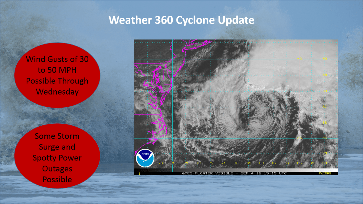
Hurricane Matthew Bears Down on Caribbean, Poses Threat to US

The monster  category 4 Hurricane Matthew is now beginning its path of destruction as it nears the northern Caribbean Islands. Up to over a foot of rain is expected over a wide swath of Haiti, Cuba, and Jamaica, creating the possibility for mudslides and flash flooding.

The National Hurricane Center has forecasted the storm to barrel through The Caribbean and The Bahamas before potentially impacting the US.

Hurricane conditions can be expected across Jamaica, eastern Cuba, and all of Haiti over the next 48 hours, and hurricane conditions are increasingly likely for large swaths of the Bahamas as well as The Turks and Caicos.

After about 72 hours out, the forecast becomes a bit less certain, as it begins to be reliant on, multiple factors, for now, we’ll focus on two.

  • Factor 1: The low pressure system in the Pacific Northwest is weaker than expected, meaning that once it reaches Hurricane Matthew on the East Coast (if at all), it will not be able to slingshot the storm away from the coast as previously thought.
  • Factor 2: The high pressure system in the Atlantic is much more dominant than expected, indicating that it may act as a block in Matthew’s path, forcing it much, much closer to the coast, as reflected in last night’s shift in the spaghetti model plots.

*Hurricane Matthew is an extremely dangerous storm, it is highly recommended to prepare and evacuate as ordered by your local governments should they do so. Please consult The National Hurricane Center at http://www.nhc.noaa.gov for more info.*

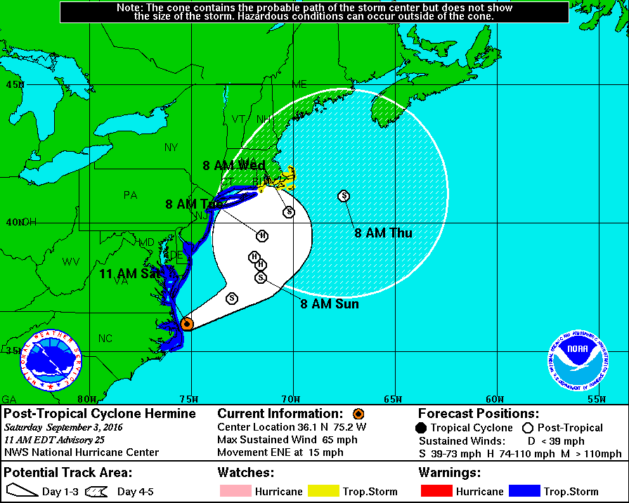
Tropical Storm Warnings For Tri-State Area

The National Weather Service in Upton, New York has issued Tropical Storm Warnings for locations across The Tri-State Area. Storm Surge Watches and Warnings are also in effect.nhc hermine post tropical ts warnings.gif

Sustained winds in excess of 40-60 MPH are possible with this storm from New Jersey to Connecticut, creating the potential for widespread power outages, blocked roads, and high waves. The National Hurricane Center is expecting a storm surge of anywhere between 1 and 8 feet depending on the location, especially on the south facing shores of Long Island. Now is the time to act! Make sure you have a 3 day supply of food and water as well as flashlights, a weather radio, and portable batteries if at all possible. If evacuations are ordered for your area, do not hesitate to leave. The potential track for this storm remains somewhat uncertain, so please stay informed over the following several days. Official information may be found at hurricanes.gov (NHC), and at weather.gov (NWS).

Tropical Depression Nine Expected to Become a Tropical Storm Today; Track Uncertainty Remains in the Long Term

Tropical Depression 9, the swirling mass of clouds just to the north of The Yucatan in the image to the left, is expected to intensify into a Tropical Storm sometime over the next several hours. The warm waters of The Gulf combined with little shear has finally allowed this storm to grow rapidly over the past couple of days. The National Hurricane Center (NHC) has issued Hurricane Watches as well as Tropical Storm Warnings for much of the Big Bend area of Florida north of Tampa. Although the storm is not currently expected to become a hurricane before landfall,  it will come close to doing so with sustained winds of about 65 MPH, so Hurricane Watches are still in effect for the area. Although a sort of model consensus has been reached regarding the short term for this storm, mayhem continues as some computer models have begun to indicate a shift to the west once it passes North Carolina. If this storm were to shift to the west as now indicated by some of the more trustworthy computer models, it would mean that impacts from this storm would be felt as far north as New England.  As of now, The NHC has put a 50% chance of a 3 to 5 foot storm surge occurring in The Long Island Sound, but until the computer models receive more information, it is unlikely we will know the exact track.  More updates will ne available here over the next several days, but please visit The National Hurricane Center at nhc.noaa.gov before making any decisions.