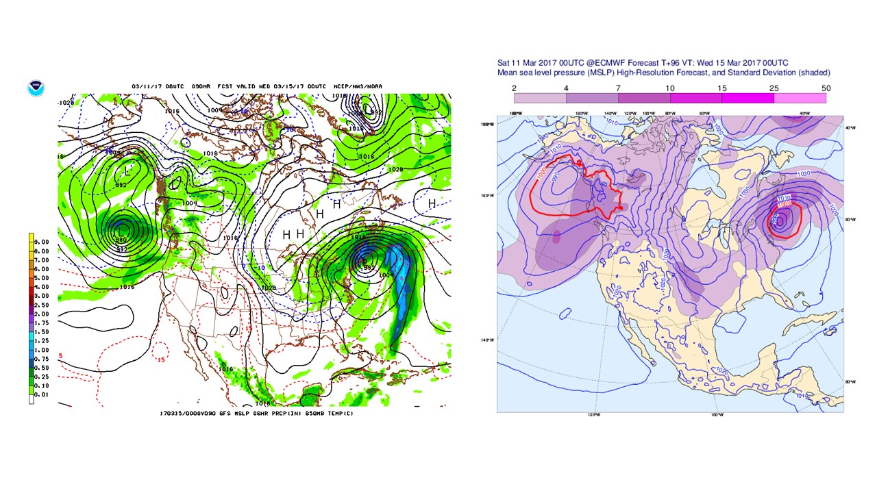
Aside from several inches in November, it has been ten months since there has been significant snowfall seen in the New York City Metropolitan Area. This is now expected to change as soon as this weekend, as a significant winter weather event has begun to move east.

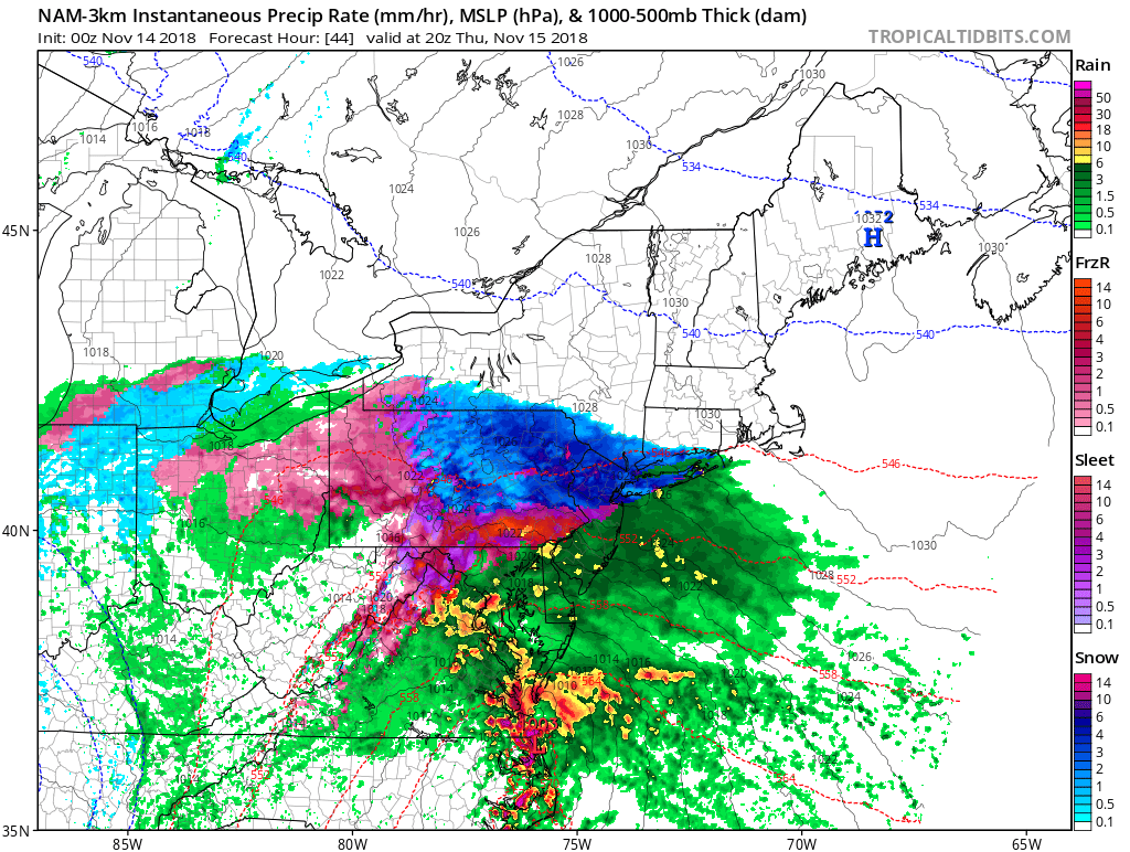
Snow will quickly develop and intensify as it moves into the Tri-State Area late Saturday evening or early Sunday morning, bringing with it rapid accumulations on most surfaces. However, the position of the storm will dictate if and when many locations will see a changeover to sleet, ice, or rain.
At the moment, it appears that locations north of the city and I-95 will experience this transition as early as 9 am Sunday, allowing for potentially significant ice accretions on many surfaces by noon Sunday.
Whether or not the precipitation remains frozen or becomes rain during the day, snow and ice will redevelop by the afternoon as temperatures drop and winds increase Sunday night. It is also important to note that, regardless of the direct impacts of the storm, temperatures will fall to near below zero throughout the Mid Atlantic and New England by early Monday morning. This rapid refreezing could mean any liquid precipitation that falls may become ice on roads, trees, and power lines quickly after the storm exits the area.

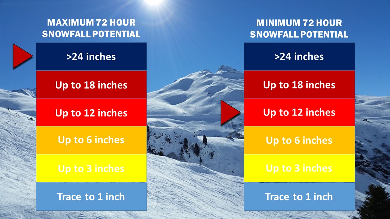
Due to the uncertain nature of the this storm, Weather 360 is currently forecasting anywhere between 4 and 12+ inches north of I-95, with anywhere between 3 and 8+ inches to its east and south. Forecasts will be refined in the coming days as the center of the storm develops, but for now, be prepared for a storm that could knock out power, make travel dangerous for an extended period of time, and dump a significant amount of snow, sleet, ice, and rain.