A developing nor’easter is promising to bring the season’s first significant snowfall to the NYC tri-state area later this week.
This is the first Weather 360 forecast made with the aid of a new forecasting algorithm tailored to the NYC Metro Area. Updated as of 8 pm ET Tuesday, November 13, 2018.
The heaviest snowfall will likely be around or after sunset Thursday with the potential for some light icing around midnight. Though while the storm system may bring upwards of half a foot of snow or more to some locations by late Thursday night or early Friday morning, due to the warm air brought by the proximity of the center of the storm to the coast, come the morning commute on Friday most of it will be more slush than snow.
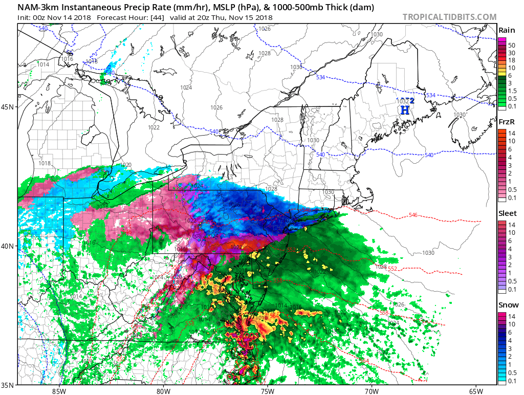
The potential for heavy snow to develop quickly Thursday afternoon over the NYC Metro Area.
As with most winter weather events this early in the season, slight changes in track can mean the difference between freezing and above freezing and rain and snow. However, due to the possibility for snow to accumulate within minutes on some surfaces, travel may become hazardous from mid-afternoon Thursday through late morning Friday.