Weather 360, Four Years On

Four years ago, in September of 2014, Weather 360 was first launched with one goal: To provide local and accurate weather forecasts. Since then, Weather 360 has served tens of thousands of people from dozens of countries around the world as it has expanded coverage from the 20 million people who live in the New York City Tri-State Area, to the entire Tropical Atlantic during Hurricane Season, and occasionally beyond.

Currently, after spending several seasons working on new methods of refining forecasting methods, Weather 360 is pleased to announce that its own systematic and statistical approach to weather forecasting – derived from data collected and analyzed in the New York City area – will be employed this winter to help facilitate the creation of our own forecasts. Formed from a variety of sources – whether it be from real-time data, shorter-range mesoscale computer models, or longer-range global computer models – the methods Weather 360 continues to expand upon to create and provide weather forecasts has only improved.

Weather 360 has also undergone many changes since it first came into existence: Beginning with launching a Facebook page nearly two years ago, reformatting its – well – format, and working on a YouTube channel that will effectively deliver information that cannot always be so easily delivered via text. Furthermore, to celebrate its fourth anniversary, Weather 360, in an effort to extend its ability to give weather-related information and advice to more people, has begun providing certain services in French and English for those who reside in French-speaking regions of The Caribbean, Canada, and The United States.

Once again, Weather 360 would like to thank all of its visitors for relying on us to provide their weather.

Thank you and stay safe!

Announcement of Services in French/Annonce de Services en Français

Announcement of Services in French

Welcome to Weather 360. As of now, as we approach our fourth anniversary, Weather 360 will be providing information in French, as well as in English, to French-speaking regions of the Caribbean and Canada when there are meteorological threats to the indicated regions (below). After recent hurricanes in the Caribbean, we noticed that there were many people from these French-speaking regions who used Weather 360 for information, more people than used us in the entire previous month. Therefore, it is with pleasure that we announce the start of services in French. Thank you for using Weather 360 and stay safe!

Annonce de Services en Français

Bienvenue à Weather 360. Désormais, comme nous approchons notre quatrième anniversaire, Weather 360 rassurera des infos en français et en anglais aux régions francophones du Caraïbe et du Canada quand il y a des menaces méterologiques aux régions indiquées. Après des ouragans récents au Caraïbe, nous avons noté qu’il y avait beaucoup de personnes de ces régions francophones qui ont utilisé Weather 360 pour des infos, plus de personnes qui nous ont utilisés pour le mois antérieur entier. Donc, c’est avec plaisir que nous annonçons la commence des services en français. Merci d’utiliser Weather 360 et restez en sécurité!

Caribbean Languages

Canadian Languages

Description Français : Carte montrant les langues parlées dans les différentes régions du Canada.

English: Map of Canada showing the language spoken in different regions of the country.

Caption English/Anglais (1)

English and French/ Anglais et Français (2)

French/Français (3)

Image Sources/Les Sources d’Images: Wikipedia/Wikipédia

Largest Winter Storm of Season Takes Aim at NYC Tri-State

The National Weather Service has issued Winter Storm Warnings for locations across New York, New Jersey, and Connecticut. Snow showers earlier this morning left 1-3 inches of snow on grassy surfaces across the area, but the brunt of the storm is only now beginning to move over Long Island and New Jersey. Heavy bands of snow developing this morning will intensify throughout the afternoon, bringing with them snowfall rates upwards of 2 inches per hour and wind gusts of 30-40 mph.

Snow Accumulation 18-3
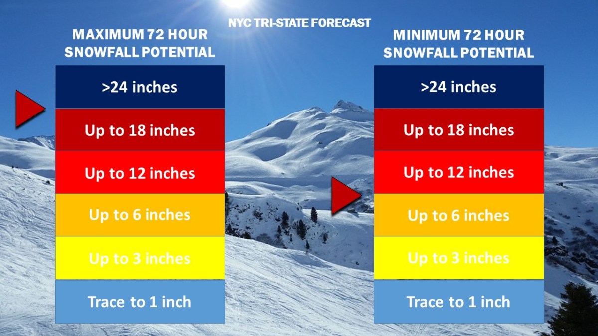
Weather 360 NYC Tri-State 72 Hour Snowfall Forecast as of 9:30 AM today.

While snow totals to the east of the city in Long Island will likely remain at or below the one foot mark, locations to the west, northwest, and north of the city have the potential to reach over 18 inches of snow by Thursday morning.

Due to high winds combined with heavy snow this afternoon, it is advised that all unnecessary travel is avoided until the storm subsides tomorrow.

Strong Nor’easter to Develop Friday

A strong Nor’easter is expected to develop from a center of low pressure that will move from the Midwest over the Mid Atlantic coast Thursday night. Strong winds and heavy precipitation will likely create power outages and hazardous travel on Friday.

NAM Radar Friday March 2 2018 Noon
NAM 3km computer model display of potential weather conditions at noon on Friday. (image from tropicaltidbits.com)

While it is certain that a Nor’easter will strengthen rapidly over the Mid Atlantic coast, the type of precipitation received in the NYC Metropolitan Area will depend on its proximity to the coast. As of this afternoon, the ECMWF (European) and the NAM (North American) computer models are forecasting enough cold air to transition the heavy precipitation into snow by 10 am or noon Friday. Snow totals in locations where the precipitation does change over to snow could see snow totals exceeding half a foot to over a foot of snow by Saturday morning.

Snow Accumulation 18-2
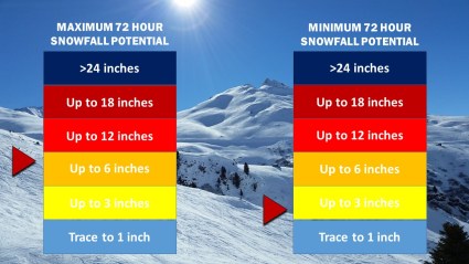
Weather 360 72 Hour Snow Total Forecast Graphic as of 4:00 PM ET 2/28/2018.


Blizzard Disrupts Travel As Paralyzing Cold Moves In

A significant winter storm has brought up to 12 inches or more of snow along with wind gusts exceeding 60 mph to the Northeast. Schools remain closed throughout southern New York, New Jersey, and Connecticut as wind speeds of 40 mph create wind chills approaching 25 below zero. The National Weather Service has issued wind chill advisories for the area warning of the potential for frostbite to occur within 30 minutes of exposure to the record-breaking low temperatures.

1 5 18 Temperatures NAM
Low temperatures are expected to approach 0 degrees throughout the area with wind chills reaching minus 20 by the morning.

Expect high winds to continue to create low visibility going into Friday afternoon with the potential for downed trees and tree limbs lasting until Sunday morning.

Potential for Significant Nor’easter Soon

A low pressure system is forecasted to develop off the coast of Florida this Tuesday, at which point it has the possibility to come close enough to the coast to impact the Northeast by Thursday.

ECMWF Forecast 12 31 17
European Computer Model (ECMWF) run for Thursday, January 4, 2018, depicting a strong low pressure developing several hundred miles off the US East Coast. (Image courtesy of Weather.us)

As low temperatures correlate to higher yields of snow from the same amount of liquid precipitation, should the storm system track any closer to the coast, upwards of half a foot to a foot of snow or more could be possible. At this time it is still unknown as to whether or not the storm will come close enough to impact the NYC area, but the potential exists for a significant winter storm or blizzard come later this week.

First Winter Storm of Season Expected Saturday

Winter Weather Advisories and Winter Storm Warnings are currently in effect for locations along the I-95 Corridor. While snow accumulations through Sunday morning will likely range from 3” to 6” across much of the NYC Metro Area, the possibility for greater snow totals does exist should the storm system shift to the west, as does the possibility for lower totals in the event that the storm shifts to the east.

NAM3km Rain Snow Forecast December 9 2017
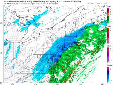
The NAM 3km computer model run from Friday afternoon depicting heavier bands of snow developing across New England by 3 pm. Image from Tropicaltidbits

As the center of low pressure continues to develop, snow has begun to fall across portions of southern New Jersey and is expected to impact our area starting sometime in the mid-morning Saturday. While snow totals will likely remain below the 10” mark, expect moderate snow from around noon to 8 pm Saturday with the potential for some bands of heavier snow around the mid-afternoon. Most roadways will begin to see light accumulations of snow within one to two hours of the first flakes, meaning that all roadways will become slippery by the afternoon and evening.

Snow Accumulation 17-1.jpg
Weather 360 snow accumulation graphic for Saturday December 9, 2017. 3″-7″ can be expected across the NYC Metro Area.

Welcome Back to the New Weather360

After a two month developing phase, Weather360 is back up and running even better than ever.  Over the following weeks, a new Severe Weather Forecasting System will be implemented to give specialized information regarding the New York City Metro Area.  Along with this, we plan to provide more insight into oncoming storm systems that may impact the Metro Area as well as large storm systems that may deliver severe outbreaks across the country.