The Latest: Rain, mild temperatures, more Weather 360 news, and the list goes on

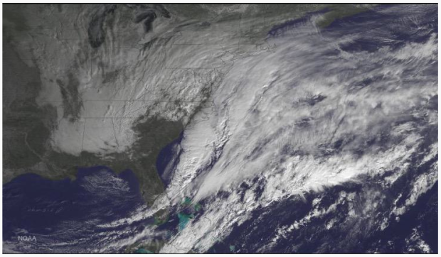
As most of you probably know, it is raining in the Northeast.

Again, way to state the obvious, but what that doesn’t mention is there is the potential for some severe storms and weather to roll across the Mid Atlantic and New England.  Be aware for some isolated storms that may bring lightning, heavy downpours, and small hail.  Refer to the NWS or NOAA for emergency information.

The Latest:  SPRING IS HERE! THE NORTHEAST IS WINTER FREE!  Well, at least for the most part…

For areas in southern parts of New England and most of the Mid Atlantic it may seem as if winter is well on it’s way out of the area,  but there is still the potential for at least two more small Jet Stream dips, bringing back a small taste of winter to remind everyone that April can be a volatile month in terms of temperatures.  Be on the lookout for some freezing of water on roadways in a few days in northern portions of the Northeast.

Stay safe!

The Latest:  Typhoon in the Western Pacific

The typhoon in the Western Pacific has it’s eyes on the Philippines and then southeastern parts of China.  The typhoon has already reportedly killed one person and is now expected to hit the Philippines as the equivalent of a moderate to strong category two cyclone (winds around 105-110 mph.)  The typhoon could dump up to ten inches of rain in the Philippines and China, this creating the possibility of some landslides in more hilly and mountainous areas.

The Latest:  Schedule changes?  We need your feedback on this!

What do you think? Should there be a schedule change for Weather 360?  Send us your opinion on this via a poll we will release tomorrow.  When you answer the poll, please answer honestly.

Weather 360 news and days of storms ahead for the Mid Atlantic

First off today we will talk about the rain now, and of course, the potential for a several day long period of storms next week.  Scroll to the bottom to also view some website news.

Back to the rain now

The rain falling across the Northeast today is apart of a large and widespread storm system moving across the United States right now.  There is the potential for some of the severe storms to impact locations further south, especially in the Mid Atlantic.  The severe storms could include some small hail, gusty winds, frequent lightning, and the slighter side of the potential for some isolated tornadoes or micro bursts (sudden areas of a large downdraft of wind, this causing a similar amount, but more isolated, damage of a weak tornado.) Be careful and heed all warnings.

The rain next week

Again, mainly closer to and in the Mid Atlantic will be the potential for rain and severe storms.  The timing of the rain event will go as so:

First, there will be mainly rain showers starting later on during Monday,  but from there the storms will start to become more severe and large.  Likely by Tuesday though, the storms in the Mid Atlantic will become severe, spreading further north, but not with the same magnitude. The storms should begin to wrap up by Friday, bringing with that, warmer temperatures and sunny conditions.  If you really want to see what spring has to offer, you likely are very eager for next weekend to arrive.

Heed all warnings, and stay safe!

Weather 360 news

Go to https://www.youtube.com/channel/UCHWTxO538BC1k2fTp8-Wn2A to view our YouTube channel, currently we only have our promotional video, but we are working on developing new videos to report on Northeast weather along with Atlantic Basin tropical (and, if considered a storm by the NHC, sub-tropical) cyclones.  The videos will include some of the same, but definitely also different information than what is shown out our website along with Weather 360 announcements.

Soggy Northeast today, tomorrow, and just when it is all dry, more rain next week

By the end of today, most of the dry places in the Northeast will be soggy and damp with rain.  If it has not already rained or started raining near you in the Northeast, be ready for some spring time showers coming your way.

The severe side

Today there is the potential for some severe thunderstorms to impact some locations in the Northeast, especially towards the southern end of the region.  These thunderstorms, although not likely capable now, are the same if not the ones near other thunderstorms in the Mid West that created some tornadoes.  To our knowledge, it is not likely for a location in the Northeast to sustain a tornado (visit our ‘Terms to Know’ page for the NWS definition), even a fairly weak one. Remember though, there is always the potential a tornado, so heed all NWS service watches and warnings (most of them though will just tell you to take shelter, which is always a good idea, especially in a severe storm of any kind.)

If you see a flooded roadway, do not drive through it, the depth of the water could be much greater than what your eyes decide.  TURN AROUND, DON’T DROWN! (It seems you will hear that a lot on TV when they talk about rain.)

On that note, stay safe!

The Latest: Warmer temperatures, rain, thunderstorms, spring is here to stay

Spring has liberated the following areas from winter:  Most of the Northeast, and the rest of the mid latitude parts of the US as a whole…

The Latest:  SPRING IS HERE TO STAY!

Sorry Vermont and Quebec, the maple season was a short one, with temperatures so warm for so long, with then a two month blast of below freezing temperatures, then a sudden warm up to wrap up and purge winter from the area.

The Latest:  Tomorrow’s rain

Although today may have been considered the first real spring day for the Northeast this season, spring does have its drawbacks…

One of these drawbacks, of course, includes the constant threat of showers and some severe thunderstorms, which is exactly what the Northeast will experience tomorrow along with the milder temperatures.

The Latest:  Hurricane season is still ongoing in the Pacific

There is a currently equivalent of a category 3-4 hurricane swirling away near the Philippines, which is its target.  Fortunately for them, the storm will weaken to around a category 2 status, with winds around 110 MPH.  This storm will cause severe flooding in some areas there, and they should be ready for a storms surge possibly over 10 feet in most coastal regions.

Sorry for the delay in this post, there were some maintenance issues, stay safe!

Watch out Northeast, there’s a storm brewing

Over the next one or two weeks there is the possibility for a lot, and we mean a lot of rain and thunderstorms to arrive in the Northeast.

First, we would like to talk about the current rain and thunderstorms in the parts of the Northeast, especially Pennsylvania and New York.  The current storms rolling across the two Northeast states are bringing with them some lightning, hail, and localized flooding.  These same storms are expected to arrive in most of New England and eastern parts of the Mid Atlantic by tomorrow night, less severe, but will still bring a lot of rain to these areas.  Watch out for some flooded roadways, including and especially underpasses and some tunnels with poor drainage. DO NOT DRIVE THROUGH THESE ROADWAYS IF THEY ARE FLOODED, TURN AROUND, DON’T DROWN!

So to wrap it all up, be careful, and stay safe!

Spring time for real? Okay, but what do the computer models have to say about this?

Is it really spring?

Yes, it is springtime right now, but will winter’s wrath have that stand?

GFS computer model:  This computer model is suggesting that warm temperatures will arrive and be in the Northeast to stay for at least a while after April 7th.  Though, there is the potential for some snow in northern parts of the Northeast after that.

European (ECMWF or Euro) computer model:  The European model does agree with the GFS for the most part, but instead of a steady stream of cold air for the northern parts of the Northeast US, the European model suggests more in the way of some cold spells that will affect parts of the Northeast (northern) and large portions of Canada.

Be careful, there may be some spotty black ice over the next several days, so stay safe!

The Latest: Milder temperatures coming, bringing with it some April showers

Winter is well on it’s way to ending, but will still attempt to come back over the next several weeks, likely only to loose to the warm air once again.  Watch out for some slick roads tomorrow.

The Latest:  Warm temperatures

Starting tomorrow across the Northeast warm temperatures actually above average will start to settle in, helping to diminish any snow remaining in southern portions of New England.  Most of the temperatures to be seen tomorrow will be around ten degrees above average, so about 60 degrees in most places.

The Latest: Rain, rain, and of course, more rain

Starting tomorrow evening, rain showers will start to move in and be in the Northeast to stay at least until Friday night.  The system will bring with it generally two inches, with locally higher amounts across the Northeast.  Be aware of the possibility of some isolated severe thunderstorms in this system.

Stay safe!

Was yesterday the last day this season for daytime snow for most of the Northeast?

Big blizzard 2015 that was not... The so called “Blizzard of 2015” that was really not for most areas (except for Boston because you know, since no one else wanted the snow the blizzard decided to just dump it all on them…)

So was yesterday the last daytime snow in the Northeast this wintry-springy hybrid season…?

Maybe for the major cities such as New York and Boston, but for extreme northern parts of New England there is the potential for some more daytime snow not just overnight flurries…

Before the end of April there will likely be several more clippers and larger storm events that could bring mainly rain for the Northeast, but some more, fresh snow in northern areas of Maine, New York, Vermont, and New Hampshire. (This all over the next several days and couple of weeks.)

Be aware of the potential of melting and refreezing creating patchy areas of black ice across New England and the northern parts of the Mid Atlantic.

Stay safe!

Cooler temperatures now, warmer temperatures tomorrow

Today is April 1st 2015, the average highs today in the Northeast will be around 45, this is about ten degrees below average, but tomorrow, the temperatures will be virtually the same as the historical average in most locations in the Northeast.  The big deal though is this Friday, this Friday, is the first time in most locations in the NYC Metro Area and about everywhere north of there to see temperatures above average this spring.  Temperatures in NYC will be around 60 on Friday, whereas locations such as Philadelphia will have temperatures colder to the mid/upper 60’s.  Although warm temperatures are coming, yesterday was a reminder wintry weather can occur almost anytime in early spring.

Be aware of the possibility of some black ice, and stay safe!

The Latest: Snow on the ground for April First? Or just another cruel April Fools joke?

Are you kidding me?

Though winter was over?  Once again, you may have thought wrong…

The Latest:  Snow in the Northeast, (sigh…)

APRIL FOOLS!  Just kidding the snow falling is actually real…

If it is not already, rain will transition to snow and start to accumulate in areas north of NYC soon.  In areas already seeing this transition there is up to almost an inch of snow, covering most grassy surfaces with yet another fresh round of snow.  Check out our new ‘School Closure Index’ page to see the general odds of school closings, delayed schedules, and early dismissals across the areas affected by the storm.

The Latest:  We have mentioned again and again that the warm temperatures are coming, so when exactly will they come here to stay?

Soon most hope, but there is again the potential for a few more cold spells in the Northeast before winter’s last breath will be exhausted.  The truth is that warmer temperatures will become more normal and average over the next week, but again, there is the potential for some more, not as cold, but cold, spells dipping into the Northeast.  Be aware of the possibility of some localized areas of black ice tomorrow and the next day due to melting and refreezing.

Stay safe, and stay warm during the snow.