Spring time for real? Okay, but what do the computer models have to say about this?

Is it really spring?

Yes, it is springtime right now, but will winter’s wrath have that stand?

GFS computer model:  This computer model is suggesting that warm temperatures will arrive and be in the Northeast to stay for at least a while after April 7th.  Though, there is the potential for some snow in northern parts of the Northeast after that.

European (ECMWF or Euro) computer model:  The European model does agree with the GFS for the most part, but instead of a steady stream of cold air for the northern parts of the Northeast US, the European model suggests more in the way of some cold spells that will affect parts of the Northeast (northern) and large portions of Canada.

Be careful, there may be some spotty black ice over the next several days, so stay safe!

The Latest: Milder temperatures coming, bringing with it some April showers

Winter is well on it’s way to ending, but will still attempt to come back over the next several weeks, likely only to loose to the warm air once again.  Watch out for some slick roads tomorrow.

The Latest:  Warm temperatures

Starting tomorrow across the Northeast warm temperatures actually above average will start to settle in, helping to diminish any snow remaining in southern portions of New England.  Most of the temperatures to be seen tomorrow will be around ten degrees above average, so about 60 degrees in most places.

The Latest: Rain, rain, and of course, more rain

Starting tomorrow evening, rain showers will start to move in and be in the Northeast to stay at least until Friday night.  The system will bring with it generally two inches, with locally higher amounts across the Northeast.  Be aware of the possibility of some isolated severe thunderstorms in this system.

Stay safe!

Was yesterday the last day this season for daytime snow for most of the Northeast?

Big blizzard 2015 that was not... The so called “Blizzard of 2015” that was really not for most areas (except for Boston because you know, since no one else wanted the snow the blizzard decided to just dump it all on them…)

So was yesterday the last daytime snow in the Northeast this wintry-springy hybrid season…?

Maybe for the major cities such as New York and Boston, but for extreme northern parts of New England there is the potential for some more daytime snow not just overnight flurries…

Before the end of April there will likely be several more clippers and larger storm events that could bring mainly rain for the Northeast, but some more, fresh snow in northern areas of Maine, New York, Vermont, and New Hampshire. (This all over the next several days and couple of weeks.)

Be aware of the potential of melting and refreezing creating patchy areas of black ice across New England and the northern parts of the Mid Atlantic.

Stay safe!

Cooler temperatures now, warmer temperatures tomorrow

Today is April 1st 2015, the average highs today in the Northeast will be around 45, this is about ten degrees below average, but tomorrow, the temperatures will be virtually the same as the historical average in most locations in the Northeast.  The big deal though is this Friday, this Friday, is the first time in most locations in the NYC Metro Area and about everywhere north of there to see temperatures above average this spring.  Temperatures in NYC will be around 60 on Friday, whereas locations such as Philadelphia will have temperatures colder to the mid/upper 60’s.  Although warm temperatures are coming, yesterday was a reminder wintry weather can occur almost anytime in early spring.

Be aware of the possibility of some black ice, and stay safe!

The Latest: Snow on the ground for April First? Or just another cruel April Fools joke?

Are you kidding me?

Though winter was over?  Once again, you may have thought wrong…

The Latest:  Snow in the Northeast, (sigh…)

APRIL FOOLS!  Just kidding the snow falling is actually real…

If it is not already, rain will transition to snow and start to accumulate in areas north of NYC soon.  In areas already seeing this transition there is up to almost an inch of snow, covering most grassy surfaces with yet another fresh round of snow.  Check out our new ‘School Closure Index’ page to see the general odds of school closings, delayed schedules, and early dismissals across the areas affected by the storm.

The Latest:  We have mentioned again and again that the warm temperatures are coming, so when exactly will they come here to stay?

Soon most hope, but there is again the potential for a few more cold spells in the Northeast before winter’s last breath will be exhausted.  The truth is that warmer temperatures will become more normal and average over the next week, but again, there is the potential for some more, not as cold, but cold, spells dipping into the Northeast.  Be aware of the possibility of some localized areas of black ice tomorrow and the next day due to melting and refreezing.

Stay safe, and stay warm during the snow.

Snow is falling now, warm up tomorrow could spell for black ice and flooding

Right now, if you live in the Northeast it may seem as if there is a pre-taped video from February rolling outside on your windows now, but we can assure you that is not the case.  The snow we are taking about that is falling across New England and the Mid Atlantic could leave the areas talked about with several more inches of fresh snow and the threat of black ice tomorrow along with some flooding.  Please be aware of the possibility of black ice and flooding even today, but expectantly over the next few days.

We will update you soon and stay safe!

After shocks continue in Southwestern Pacific, warm is in the forecast for the Northeast US

Hundreds of smaller aftershocks are shaking up Papua New Guinea today after the 7.7 magnitude earthquake struck yesterday.  Back to the Northeast,  warm temperatures, and some more snow are in the forecast.

Tomorrow evening and night in cold enough areas of parts of New England and northern portions of the Mid Atlantic, there will be some snow and wintry mix as the result of the transition from rain to frozen precipitation.  Though some cold temperatures and freezing precipitation tomorrow night is expected, warmer temperatures are on the way for the Northeast’s major cities, New York City, Boston, Philadelphia, etc.  By the end of this week there is the potential for a day of very mild temperatures all over New England and the Mid Atlantic (around 60 degrees in the NYC Metro Area, with temperatures slightly cooler/warmer depending on location.)

Be prepared for a sudden warm up then another small cool down over the next several days, and as always stay safe!

There is going to be a special announcement regarding this website either in today’s edition of ‘The Latest’ or tomorrow.

Update on snow in the Northeast and earthquake/tsunami in Pacific

As several light to moderate bands of snow move through the Northeast, new observations from Papua New Guinea are starting to come in.  Overnight, there were two more earthquakes in the area, causing a tsunami statement to be released (both earthquakes were around 6.5.)

The earthquake created a small tsunami measures around one meter (3 feet) according to one report in Papua New Guinea, there was no other observations of a tsunami.  More after shocks are expected throughout the Southwestern Pacific.

The snow in the Northeast has brought around a fresh new inch across some areas, but otherwise, not much more in way of accumulations today in the Northeast because soon in inmost places the temperatures will warm to above freezing.

Stay safe!

The Latest: Spring snow could cause travel hazards tomorrow, but then…

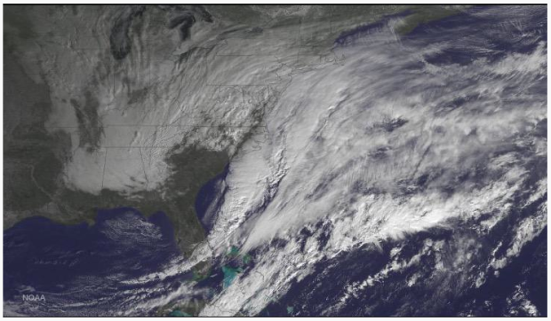
Tomorrow some spring snow showers are expected to move through northern portions of the Northeast United States.  This could create some slippery roadways across areas affected by the snow and wintry mix.

The Latest:  Next several day temperature forecast

Over the next several days warmer and more mild temperatures will briefly invade the Mid Atlantic and New England, before cooler temperatures take over once more.  This may mean that any crops that were supposed to be planted in early April may have to have their planting dates delayed (anyways, most small gardens in New England still are covered with snow.)  Be prepared for some temperature fluctuations over the next several days, bringing with it the possibility of late night and morning snow or wintry mix.

The Latest:  When will all the snow melt!

As the snow line continues to recede across the Northeast and all of the United States, temperatures continue to rise steadily (well, at least for the most part…)

The question is though, how long until the Northeast for the most part is free of snow?

At the moment, most of the Mid Atlantic is snow free, but just north of New York City, according the National Snow Analyses, the snow depth is very close to zero, steadily rising as you look further north.  Again, back to the question, how long until it all melts?  In southern parts of New England, the snow should be mostly if not totally gone by the end of the week after next (not the snow in piles.)  In the rest of New England, most of the snow will likely be gone completely sometime later in April or in very early May.  Be aware of the potential for some black ice on roadways, and stay safe!

For the Mid Atlantic and southern parts of New England, was yesterday the last snow?

It seems as if for southern portions of the Northeast that yesterday’s snow was the last snow of the season.  This may be true, but there is still the possibility for some more wintry mix and rain events this spring for northern parts of the Northeast.  As spring and more mild temperatures slowly ooze their way back into the Northeast, the Arctic Jet Stream is ready to make it’s last moves on the northern Northeast.

When?
Over the next several days and couple of weeks would be the most likely time for a snow event to impact the northern Northeast.  With temperatures warming, the window for snow in the Northern United States is closing up.  Be prepared for warmer temperatures with the possibility of some cold infiltration over the next couple of weeks.

Above all, stay safe!