Was yesterday the last day this season for daytime snow for most of the Northeast?

Big blizzard 2015 that was not... The so called “Blizzard of 2015” that was really not for most areas (except for Boston because you know, since no one else wanted the snow the blizzard decided to just dump it all on them…)

So was yesterday the last daytime snow in the Northeast this wintry-springy hybrid season…?

Maybe for the major cities such as New York and Boston, but for extreme northern parts of New England there is the potential for some more daytime snow not just overnight flurries…

Before the end of April there will likely be several more clippers and larger storm events that could bring mainly rain for the Northeast, but some more, fresh snow in northern areas of Maine, New York, Vermont, and New Hampshire. (This all over the next several days and couple of weeks.)

Be aware of the potential of melting and refreezing creating patchy areas of black ice across New England and the northern parts of the Mid Atlantic.

Stay safe!

Cooler temperatures now, warmer temperatures tomorrow

Today is April 1st 2015, the average highs today in the Northeast will be around 45, this is about ten degrees below average, but tomorrow, the temperatures will be virtually the same as the historical average in most locations in the Northeast.  The big deal though is this Friday, this Friday, is the first time in most locations in the NYC Metro Area and about everywhere north of there to see temperatures above average this spring.  Temperatures in NYC will be around 60 on Friday, whereas locations such as Philadelphia will have temperatures colder to the mid/upper 60’s.  Although warm temperatures are coming, yesterday was a reminder wintry weather can occur almost anytime in early spring.

Be aware of the possibility of some black ice, and stay safe!

The Latest: Snow on the ground for April First? Or just another cruel April Fools joke?

Are you kidding me?

Though winter was over?  Once again, you may have thought wrong…

The Latest:  Snow in the Northeast, (sigh…)

APRIL FOOLS!  Just kidding the snow falling is actually real…

If it is not already, rain will transition to snow and start to accumulate in areas north of NYC soon.  In areas already seeing this transition there is up to almost an inch of snow, covering most grassy surfaces with yet another fresh round of snow.  Check out our new ‘School Closure Index’ page to see the general odds of school closings, delayed schedules, and early dismissals across the areas affected by the storm.

The Latest:  We have mentioned again and again that the warm temperatures are coming, so when exactly will they come here to stay?

Soon most hope, but there is again the potential for a few more cold spells in the Northeast before winter’s last breath will be exhausted.  The truth is that warmer temperatures will become more normal and average over the next week, but again, there is the potential for some more, not as cold, but cold, spells dipping into the Northeast.  Be aware of the possibility of some localized areas of black ice tomorrow and the next day due to melting and refreezing.

Stay safe, and stay warm during the snow.

Snow is falling now, warm up tomorrow could spell for black ice and flooding

Right now, if you live in the Northeast it may seem as if there is a pre-taped video from February rolling outside on your windows now, but we can assure you that is not the case.  The snow we are taking about that is falling across New England and the Mid Atlantic could leave the areas talked about with several more inches of fresh snow and the threat of black ice tomorrow along with some flooding.  Please be aware of the possibility of black ice and flooding even today, but expectantly over the next few days.

We will update you soon and stay safe!

WATCH OUT! Snow is coming just in time for the evening commute today across the Northeast

Watch out!  The Northeast, unexpectedly, is about to experience possibly up to several more inches of snow from New York City to Boston starting around 4 PM in NYC, and an hour or two later in Boston.  This storm may hassle the evening commute with up to seven inches of snow in come localized areas.  Please exercise extra caution while driving in the snow today.  There could be some bands of moderate to heavy snow today into tonight in some areas so please heed all watches, warnings, and advisories.  This is a reminder that just maybe winter is not over yet!

Stay safe!

The Latest: Special Announcement, Update on Papua New Guinea, Weather 360 news, and the warm up soon for the Northeast

On this edition of our 7 PM EST post of ‘The Latest’  we will talk about the special announcement we promised we would release, an update on the 7.7 earthquake in Papua New Guinea along with the tsunami it triggered, and the warm up headed for the Northeast, specifically the NYC Metro Area, where temperatures could soar over fifteen degrees.

The Latest:  Final update of the Papua New Guinea earthquake and tsunami

The 7.7 magnitude earthquake on the Richter Scale that shook up parts of Papua New Guinea yesterday has caused tens of large, over 4.0, aftershocks that have reminded locals and travelers there that earthquakes don’t just affect several seconds.  The small and local tsunami created by the initial 7.7 earthquake was measured around two meters at it’s top in Papua New Guinea according to some reports.  Earthquakes such as the 7.7 in Papua New Guinea test the different tsunami warning centers every time they occur, this makes sure that when there are larger earthquakes and tsunamis that the warning centers are able to issue correct and more accurate watches, warnings, and advisories.

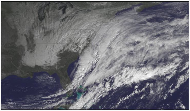
The Latest:  Warm up for the winter weary NYC, Boston, and the Northeast as a whole soon!

After the brutal winter and the morning snow has moved through the Northeast, many are hoping for a mild start to April across the I-95 Corridor.  The truth is though, that although over the next week there will be more warmth and mild temperatures across the Northeast, there is the potential for some more cold to come in briefly overt the next two weeks before being purged out of the Northeast by the springtime air.  Be ready for warmer temperatures, but be aware that there may be some more cold spells in store for the Northeast.

The Latest:  Weather 360 news along with our announcement

What Weather 360 would like to say is that our Hurricane Season 2015 cyclone prediction will be released BEFORE June 1st, meaning, with all the combined information from other organizations (ex: Colorado and NHC) along with several other different sources, Weather 360 will provide an official Hurricane Season 2015 cyclone preliminary prediction (number of cyclones only, ex: named, hurricanes, major hurricanes.)

Until then, stay safe!