
Over the next few hours, the very well defined and string tropical disturbance near the coast of the Carolinas may develop into a strong tropical storm. With sustained winds already hitting 50 MPH and a very closed and well defined center of circulation, the NHC will have to begin issuing watches and warnings for the coastal areas of the Southeast (and even potentially the rest of the East Coast.) This storm’s intensity will likely stay as a medium to strong Tropical Storm, and will likely track up through the edges of the Carolinas into the Atlantic Ocean near Long Island, before likely veering off to the east with the high pressures.
Have our look at the following graphic from Weather 360, the yellow means potential landfall locations from this storm. We apologize for the clarity of the following image.
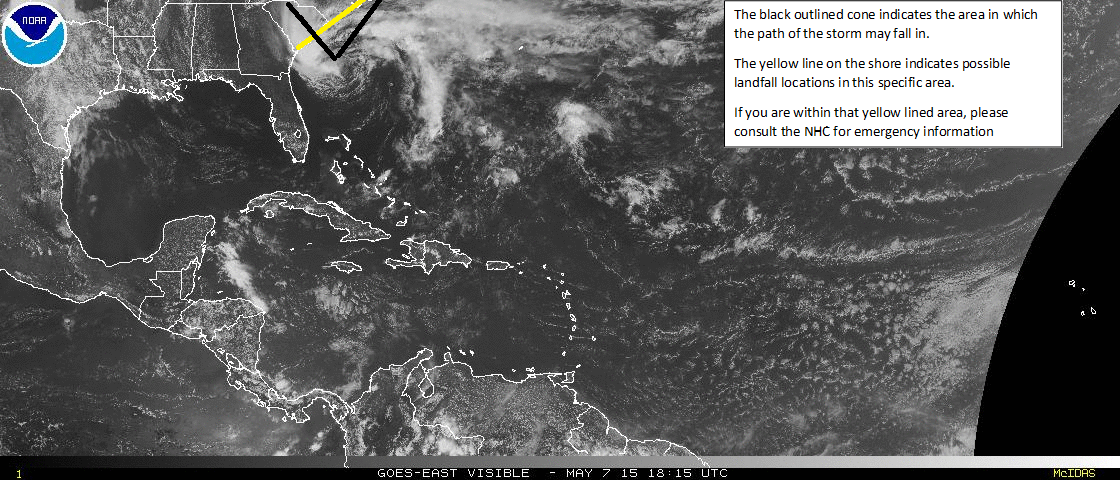
IF YOU live on or near the coast of the Carolinas, please take IMMEDIATE ACTION according to the NHC and YOUR LOCAL EMERGENCY MANAGEMENT CENTER. Please take all appropriate actions suggested by both your local center and the NHC to keep you and your property safe from the storm.
Be smart, and stay safe!
