Since 2014, Weather 360 has primarily covered the New York City Metropolitan Area. As of 2015, Weather360 began covering The Tropical Atlantic Basin as well during Hurricane Season (June 1 – November 30). The New York City Metropolitan Area is home to more than 20 million people and encompasses significant portions of 3 states. The Tropical Atlantic Basin on the other hand covers not only the coasts of the eastern and southern United States, but the coasts of Canada, Central America, as well as Caribbean nations and territories.
Below is a Weather 360 county map of the New York City Metropolitan Area.
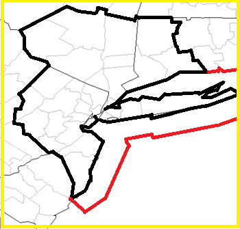
Black Outline: Metro Area Border

Red Outline: Maritime Border
------------------------------------

Weather 360 covers the following weather in the following areas:

Winter Weather- Specifically the NYC Metro Area (Nov.-Mar.)

 Severe Weather- Specifically the NYC Metro Area (Mar.-Oct.)

The Tropics- The entire Tropical Atlantic Basin (Jun.-Nov.)
